New Jersey Future Blog
Preparing for the Next Sandy Requires Facing Hard Facts
October 28th, 2014 by New Jersey Future staff
In this op-ed article for NJ Spotlight, Chris Sturm and David Kutner argue that vulnerable communities need to begin the difficult discussions about what must be done differently in order to be better prepared for the next Hurricane Sandy.
Two years after the devastation wrought by Hurricane Sandy, many of New Jersey’s coastal communities continue to struggle with recovery and rebuilding efforts. The highest community priority is to get people back into their homes, re-establish business operations and return to life as close to normal as possible. The elected officials who have led these efforts are hardworking heroes. But it’s also clear that recovery decisions made without a clear understanding of future risks can move people back into harm’s way, build infrastructure that will be damaged again, and waste taxpayer dollars. The time has come for leaders to focus on understanding risks and ensuring resiliency.
A few months after Sandy, and with the support of several private foundations, New Jersey Future initiated a program that embedded local recovery planning managers (LRPMs) in three pairs of neighboring communities – Sea Bright and Highlands, Little Egg Harbor and Tuckerton, and Commercial and Maurice River – that experienced severe hurricane damage. The LRPMs work directly with municipal staff, provide much-needed additional capacity to plan and manage recovery projects and help to secure funding for implementation.
Slideshow: The effects of sea-level rise in one vulnerable town
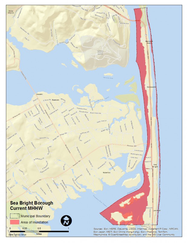
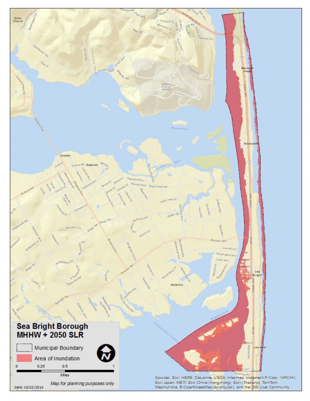
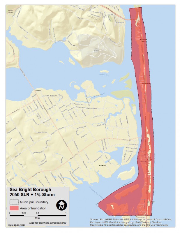


The LRPM is preparing a detailed assessment of each municipality’s risk of, and vulnerability to, future flooding and sea-level rise. (See slideshow above for maps of this analysis in the Borough of Sea Bright.) The assessment is a fine-grained, parcel-based mapping analysis that predicts depths of inundation under various future scenarios, models resulting structural damage and calculates financial exposure and potential tax revenue losses. (See Sea Bright’s projected financial exposure analysis here.) This level of detail is essential if the community is to reach a realistic determination of how and where to allocate extremely scare personnel and financial resources most effectively.
Read the full article on NJ Spotlight.
Related Posts
 June 24, 2021 Water, Water Everywhere—Achilles Heel or Asset?
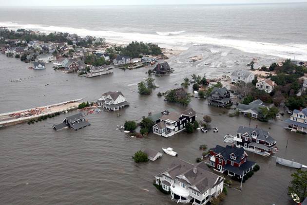 March 20, 2017 Forum Roundtable: Getting to a Regional Approach to Coastal Resilience
 January 18, 2011 BREAKING NEWS: Young People Don’t Want to Live Where Their Parents Did
 June 1, 2012 Does Traffic Congestion Make You More Productive?
 December 22, 2009 Smart Growth in Transition – Part V: Property Taxes


